Click here for weather information, etc about storm surge.
Shinsuna FloodgateThere is currently no announcement.
Opening and closing of floodgates
Illustration legend?
Legend
* The illustration shows a floodgate from the sea side and downstream, and the right end is gate 1.
Outside water level?
A.P.-mT.P.-m
Water level on the outer water area side of the floodgate (seawall) (unit is
A.P.T.P.
〇m)
Legend
※Comparison of tide level 10 minutes ago and now
Rise
Descent
No change
Missing data
Inside water level?
A.P.-mT.P.-m
Water level on the inner water area side of the floodgate (seawall) (unit is
A.P.T.P.
〇m)
Legend
※Comparison of tide level 10 minutes ago and now
Rise
Descent
No change
Missing data
Wind speed?
6.3m/s
Wind direction?
North
Gate1?
Open
Tide graph(1hour)
Wind direction and speed graph
Atmospheric pressure graph
Legend
Outside water level
Inside water level
Astronomical tide level
Wind speed
Wind directionN
Atmospheric pressure
Click here for information on the meaning of and the water level in each graph such as the inner water level, outer water level, etc.
During a storm surge, strong winds may generate high waves, so check the camera image as well.
Check here for weather information released by the Japan Meteorological Agency.
Reference water level observatory
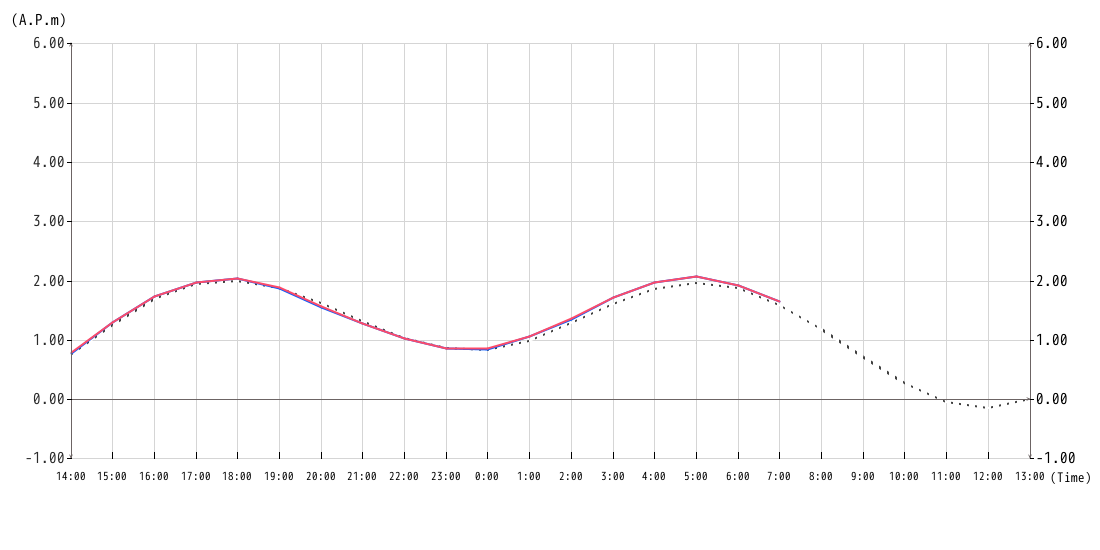
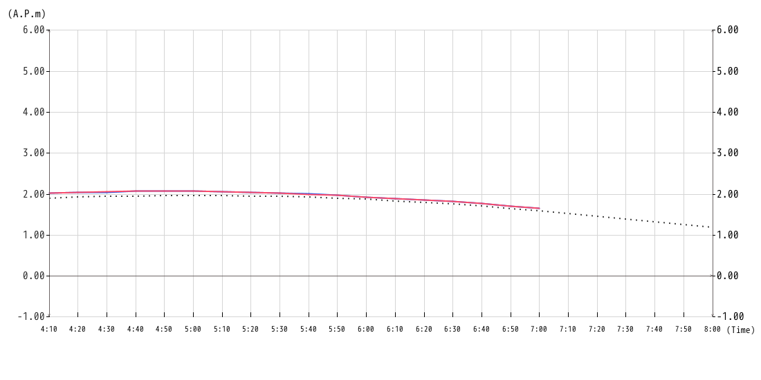
Tatsumi Floodgate (Koto City) is used as a reference water level observatory, and the water level (Surge Emergency Warning Water Level) is set as a reference to inform people of the danger of inundation due to storm surges. When the tide level is on an upward trend, also check the water level (outside water level) at the Tatsumi Floodgate.