 Tokyo Storm Surge Disaster Prevention Information System
Information as of 2026/07/14 10:32
- automatic updation
-
- Click here for weather information, etc about storm surge.
Information as of 2026/07/14 10:32

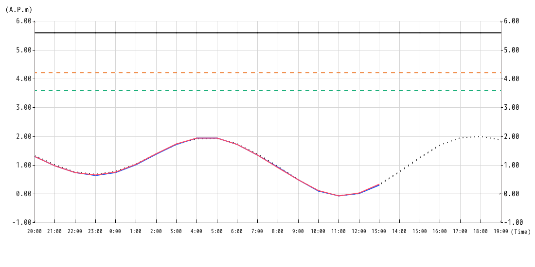
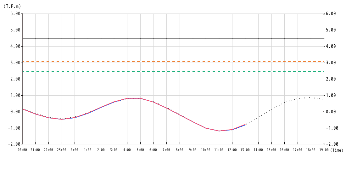
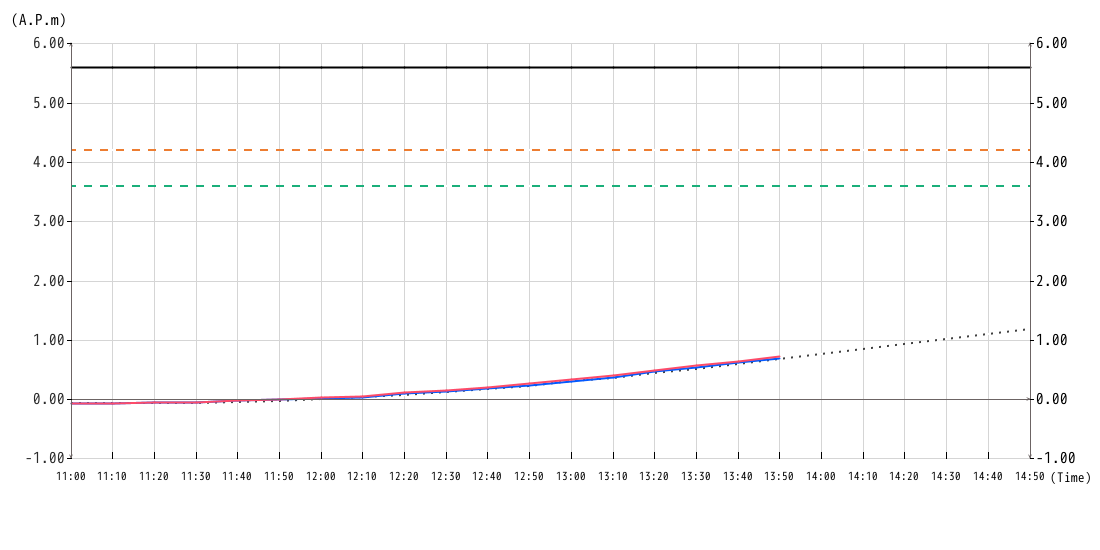
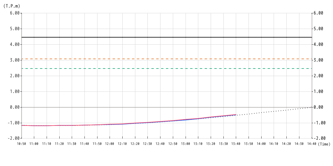
| Target areas | Storm Surge Emergency Warning Water Level |
|---|---|
| Chuo, Minato, Ota | A.P.+3.6m (T.P.+2.47m) |
| Chiyoda, Shinjuku, Bunkyo, Taito, Sumida, Koto, Shinagawa, Meguro, Kita, Arakawa, Itabashi, Adachi, Katsushika, Edogawa | A.P.+4.2m (T.P.+3.07m) |
|
|
| Current water level? |
|---|
|
A.P.
T.P.
|
When the "current water level" in the table reaches the Storm Surge Emergency Warning Water Level , "Storm Surge Inundation Information" will be announced for each water level.
The Storm Surge Inundation Information is information equivalent to alert level 5 that indicates the situation where a disaster has occurred or is imminent.
※"Current water level" shows the water level of Tatsumi Flood gate, which is the standard water level observatory for theStorm Surge Emergency Warning Water Level.

![]()